Browse categories
Explore
Fiverr Pro
English
$
USD



Professional GIS Analysis & Custom Map Creation
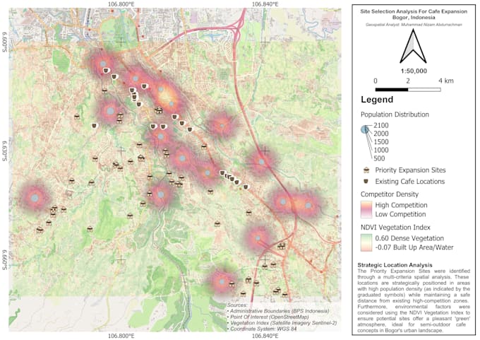
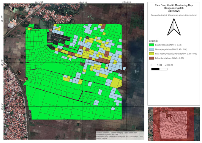
Looking for actionable spatial insights? I am a GIS Specialist expert in QGIS, SQL, and Python. I help businesses and researchers visualize geographic data to make smarter decisionsfrom retail site selection to precision agriculture monitoring.
What I Offer:
Why Choose Me?
How to Start:
Unlock the power of your location data. Order now!
Please inform the freelancer of any preferences or concerns regarding the use of AI tools in the completion and/or delivery of your order.
GIS Automation Engineer
Languages
What file formats will I receive?
You will receive the final map in high-resolution PDF, JPG, or PNG. For the Standard and Premium packages, I also provide source files such as ESRI Shapefile (.shp), GeoJSON, or QGIS Project files (.qgz).
Do I need to provide the data, or can you find it for me?
If you have specific data, please provide it in Excel, CSV, or KML format. However, if you don't have the data, I can assist in sourcing public datasets or satellite imagery (e.g., Sentinel-2 for NDVI analysis) as part of the service.
Which software do you use for analysis?
I primarily use QGIS for spatial analysis and map design. For complex data processing or automation, I utilize Python (PyQGIS/Pandas) and SQL (PostGIS) to ensure high technical accuracy.
What does a "Revision" include?
A revision includes minor changes such as adjusting the color scheme, changing fonts, or modifying the map legend. Major changes like adding new analysis or different data points after the work has started may require an additional custom offer.
Is my data safe with you?
Absolutely. I maintain strict confidentiality for all client data. Once the project is completed and accepted, I can delete your data from my local storage upon request.