Browse categories
Explore
Fiverr Pro
English
$
USD


Flood extent and land cover change mapped from satellite - with accuracy numbers to back it up.
This is my research area. I mapped the 2022 Pakistan monsoon flood scene by scene from Sentinel-1 SAR, and 30 years of land cover change and carbon loss across Lahore from the Landsat archive.
FLOOD AND WATER MAPPING
LAND COVER CHANGE
ALWAYS INCLUDED
Confusion matrix, overall accuracy, Kappa and a clear statement of limitations. Maps as GeoTIFF and PNG, stats as CSV, plus the code.
WHY ME
MSc RUDN Moscow. Manuscript under review on urban expansion and carbon loss. Flood model at F1 0.962 under a chronological split that makes temporal leakage impossible.
If satellite data cannot answer your question, I will say so. That is free.
GIS Remote Sensing Analyst
Languages
Can you map a flood that happened years ago?
Yes. Sentinel-1 SAR covers roughly 2014 onward and Landsat reaches the 1980s for optical work. Give me the date and area and I will check what imagery actually exists before you order.
Cloud covered the whole event. Is it still possible?
Yes, and this is exactly why I use SAR. Sentinel-1 radar penetrates cloud and works at night, so it captures peak flooding when optical satellites see nothing but white.
How accurate is satellite flood mapping?
Good over open water and farmland, weaker under dense vegetation and inside built-up areas where radar geometry gets complicated. I validate against independent products and state the limitations plainly rather than hiding them.
Can you predict where flooding will happen next?
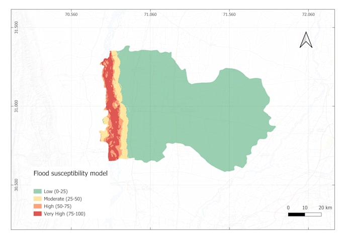
I can produce a susceptibility map showing which areas are most at risk based on past events, terrain, rainfall and land cover. That is risk mapping, not weather forecasting - an honest distinction worth making.
Do you provide the underlying data and code?
Yes on Standard and Premium. You get GeoTIFFs, CSV statistics and the full script, so your team or reviewer can rerun the analysis independently.
Can this support an insurance or legal claim?
I can provide the technical analysis and documented methodology, but I cannot act as a certified expert witness or licensed surveyor. Please confirm what your jurisdiction requires before ordering.