Browse categories
Explore
Fiverr Pro
English
$
USD
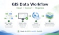
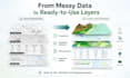
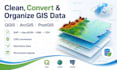
I will clean, convert, organize, and prepare your GIS spatial data for mapping, analysis, WebGIS, reports, or database use.
I can work with common GIS formats such as SHP, GeoJSON, KML, CSV with coordinates, XLS/XLSX tables, and PostgreSQL/PostGIS-ready outputs.
My services may include:
- GIS data cleaning and standardization
- Coordinate reference system checking and conversion
- Geometry fixing and validation
- Attribute table cleanup
- Converting between SHP, GeoJSON, KML, CSV, and other GIS formats
- Preparing layers for QGIS, ArcGIS, GeoServer, WebGIS, or PostGIS
- Organizing spatial datasets for mapping, analysis, or reporting
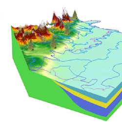
This gig is suitable for environmental data, water resources, groundwater, geology, administrative boundaries, monitoring stations, infrastructure, and technical mapping projects.
Please contact me before ordering so I can check your data format, data size, coordinate system, expected output, and delivery time.
Water Resources GIS and WebGIS Developer
Languages
What data formats can you work with?
I can work with common GIS formats such as SHP, GeoJSON, KML, CSV with coordinates, XLS/XLSX tables, and data prepared for QGIS, ArcGIS, WebGIS, or PostGIS workflows.
Can you fix geometry errors?
Yes. I can help check and fix common geometry issues such as invalid geometries, duplicated features, missing attributes, and inconsistent spatial data structure.
Can you convert coordinate systems?
Yes. I can check and convert coordinate reference systems if the source and target CRS are provided or can be identified from the dataset.
Can you prepare GIS data for WebGIS?
Yes. I can organize and prepare spatial data for WebGIS workflows, including GeoJSON, PostGIS-ready tables, GeoServer-ready layers, and clean attribute structures.
Should I contact you before ordering?
Yes. Please message me before ordering so I can review your data size, format, coordinate system, required output, and project deadline.


