Browse categories
Explore
Fiverr Pro
English
$
USD
I'm a Remote Sensing & GIS Analyst (BS Space Sciences) with hands-on experience in disaster risk mapping, environmental monitoring, and satellite-based spatial analysis currently working professionally in agri-tech and geospatial consulting.
I deliver publication-quality GIS analysis and maps for research, disaster management, environmental, and agricultural applications, using ArcGIS Pro, QGIS, Google Earth Engine, and Python (geopandas, rasterio, and GDAL).
What I can deliver:
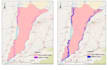
I've applied this work in real disaster-risk research (South Punjab flood susceptibility study, ROC-AUC > 0.90, prepared for journal submission) and operational drought/LULC monitoring projects.
https://portfolio-sarfarz.netlify.app/

Analysis type:
Qualitative analysis
Expertise:
Experiment design
•
Algorithms
•
Anomaly detection
Programming language:
Python
•
Java
What do you need from me to start?
Study area (shapefile/KML, coordinates, or district/region name) Type of analysis needed (flood, drought, LULC, groundwater, etc.) Time period (single date or multi-year change detection) Purpose (thesis, report, disaster planning, publication) — helps me match the output style