Browse categories
Explore
Fiverr Pro
English
$
USD


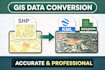
I offer professional spatial data conversion services for various GIS formats with high accuracy and fast delivery.
I can help you convert your data between different formats such as:
This service is suitable for:
Why choose me?
Note: Please contact me before placing an order to discuss your data and requirements.
GIS Mapping and Spatial Data Science
Languages
What file formats can you convert?
I can convert various GIS and spatial data formats, including: Shapefile (SHP) KML / KMZ GeoJSON CSV to spatial data Raster formats (TIFF, IMG) to vector
Can you change coordinate systems or projections?
Yes, I can transform coordinate systems such as: WGS84 UTM Local coordinate systems Just let me know your required projection.
How accurate is the converted data?
All conversions are done carefully using professional GIS tools to ensure: High spatial accuracy Correct geometry Proper attribute preservation
What software do you use?
I use industry-standard GIS software such as: QGIS ArcGIS Global Mapper
How long does it take to complete an order?
Delivery time depends on: File size Complexity of data Usually: Simple conversion: 1–2 days Complex projects: up to 3 days
