Browse categories
Explore
Fiverr Pro
English
$
USD


Hello!
I am a Geomatics student experienced in ArcGIS Pro, QGIS, remote sensing, and spatial data analysis.
Services I offer:
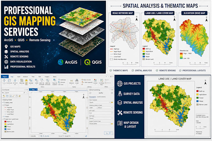
GIS Mapping
ArcGIS & QGIS Projects
Spatial Analysis
Georeferencing
Digitization of Maps
GPS Data Processing
Land Use/Land Cover Mapping
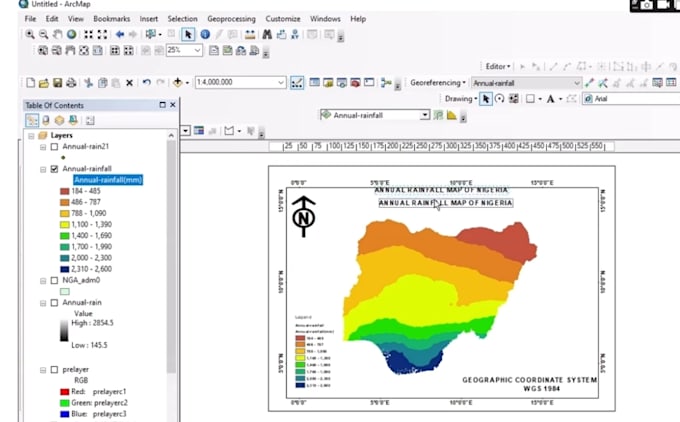
Thematic Maps
Remote Sensing Analysis
Shapefile Creation & Editing
Map Layout Design
Survey Data Visualization
Deliverables:
High-quality PDF maps
PNG/JPG map outputs
GIS project files
Professional layouts for reports, research, and presentations
Feel free to contact me before placing an order.
GIS
Languages
What software do you use?
I use ArcGIS Pro, QGIS, Google Earth Pro, and other GIS tools for mapping and spatial analysis.
What files can I provide?
You can provide Shapefiles, KML, KMZ, GeoJSON, CSV, Excel files, GPS coordinates, or any spatial data.
What formats will I receive?
I can deliver PDF, PNG, JPG, Shapefile, KML, and GIS project files.
Can you create maps from Excel data?
Yes. I can convert Excel or CSV coordinate data into professional GIS maps.
Do you provide GIS help for students and researchers?
Yes. I can assist with GIS assignments, research projects, spatial analysis, and map visualization.