Browse categories
Explore
Fiverr Pro
English
$
USD
Climate Risk and Geospatial Specialist, NatCat, Flood, GIS and Remote Sensing
Multi-peril geohazard risk modelling for regions, portfolios, and infrastructure.
THREE THINGS I DO
Reduce your flood exposure risk before it becomes a loss
Score insurance portfolios before underwriting
Turn satellite data into decision-ready risk maps
WHAT YOU GET
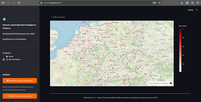
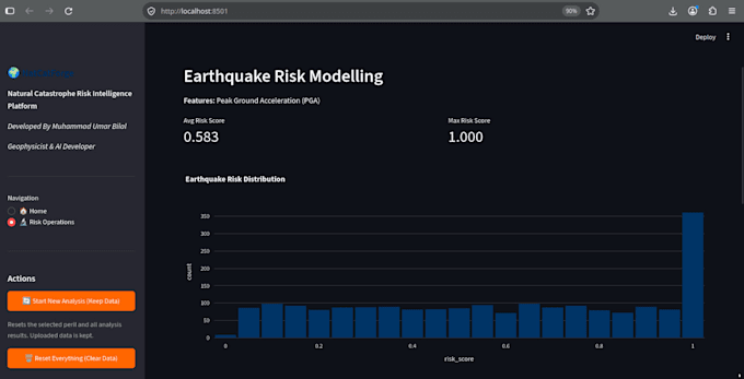
Multi-peril risk maps flood, earthquake, storm, wildfire
Risk classification: low / moderate / high / very high
Feature importance analysis which factors drive risk in your area
Methodology report for planning, insurance, or regulatory use
Optional: per-property scoring from your portfolio CSV
WHY ME
UAE flood model: 99.5% accuracy, AUC 1.00
NatCatForge: multi-peril dashboard for 800-policy insurance portfolios (2.8B exposure)
M.Sc. Geophysics, 13+ years international experience
All models validated with 5-fold cross-validation, fully documented
WHO HIRES ME
Insurers and reinsurers screening books of business
Urban planners and developers assessing site risk
NGOs and government agencies mapping disaster exposure
Environmental consultancies needing evidence-grade analysis
HOW IT WORKS
Send me your region and the perils you care about. I reply within 12 hours with scope, timeline, and recommended tier.


What perils can you model?
Flood, earthquake, storm, and wildfire — individually or combined. Additional perils (landslide, hail, tsunami) can be quoted as extras.
Is this suitable for insurance or regulatory use?
Yes. Every model includes documented methodology, validation metrics (AUC, cross-validation), and feature importance — suitable for internal review or regulator submission.
Do you work with my portfolio or site data?
Yes. Send a CSV with property/site locations (lat/long). I'll return a risk score per location. Premium tier includes full portfolio scoring.
What formats do you deliver?
PNG maps for reports, GeoTIFF for GIS software, interactive HTML for browsers, and PDF methodology reports. Full source code included on all tiers.
Do I own the output?
Yes. Full commercial rights to models, maps, code, and reports. Source code delivered with documentation so your team can rerun or extend it.