Browse categories
Explore
Fiverr Pro
English
$
USD

Level 1

We Professionally convert your topographical data in to civil 3d drawings. We create 3d surface model from survey data, gps point, point cloud data (Drone image), global mapper etc.
we create and draft existing site plan , existing surface terrain model with contours.
we use the existing surface to design.
We Create side grading plan to analyze Cut and fill area for smooth execution's of earth work. We Produce Cross sectional drawings for material volume calculation of earth works.
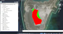
Drone Data Processing, GPS Static Data
Level 1
Languages


