I will process drone image in metashape points cloud 3d mesh, dsm, dtm, layout map

M
muhammadyamin15
M
muhammadyamin15
M Yamin

Level 1

4.7
4.7

About this gig

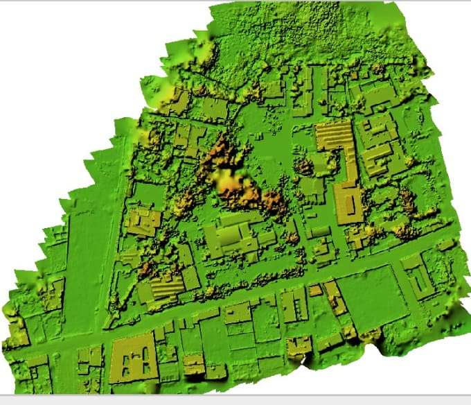
I am Expert in Making Topographic Survey Data to AutoCAD drawing & Contour Modeling

And Processing GPS Static Data and RTK Data (work in Global Mappers)

Get to know M Yamin

M Yamin

Drone Data Processing, GPS Static Data

4.9(3)

Level 1

  • FromPakistan
  • Member sinceFeb 2019
  • Avg. response time5 hours
  • Last delivery3 months
  • Languages

    Urdu, English, Hindi
I am Professional Land Surveyor with 15 years plus Experience working on Topographic survey Maps for roads, Open Land, Canal Survey, Dam Survey, Transmission Line Survey, As-Built Survey, etc. GPS Static Data Process with Trimble Business Center (TBC) Also, do Drone Data Processing.

Other Data Visualization Services I Offer

Reviews

1 reviews for this Gig
4.7

(1)
(0)
(0)
(0)
(0)
Rating Breakdown
  • Seller communication level
    4
  • Quality of delivery
    5
  • Value of delivery
    5
Sort By
Most relevant
  • T
    image-docs

    twycross3

    US

    United States

    4.7

    I specified what I wanted and it was delivered as I asked. The map is very accurate!

    $50-$100

    Price

    3 days

    Duration

    Helpful?
    Yes
    No

Related tags