I will create cloud based mapping on arc map software for you of any place on earth
M
M
Musavir
Full Screen
Full Screen
Full Screen
About this gig
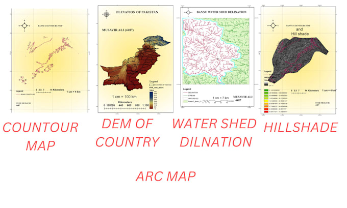
I will map follow of these
. Elevation (DEM of Study or Country)
.Geo-Referencing & Digitalization
. Water-Shed Delineation
.Map of Slope, Aspect, Hill shade and Contour
Get to know Musavir
Musavir
FromPakistan
Member sinceJun 2023
Avg. response time1 hour
Languages
English
I CAN MODAL ANY STRUCHER ON ETAB ALSO ABLE DO EARTH QUICK AND GRAVITY DESGIN .
SIMILARLY ON SAFE SOFTWAR FOR FOUNDATION WORKS. AUTO CAD BASIC STRUCTRAIL DRAWING
SUCH AS BEAM, COLUMN, SLAB ,FOTTING. I CAN DESIGN ONEWAY TWO SLAB BEAM MIX DESGIN RETANING WALL AC1-318(FPS SYSTEM) ON PAPER AND EXECL SHEET . QUANTITY COST ESTIMATE CONCERTE ,STEEL,BRICK,PAINT,