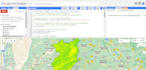
I will do geospatial analysis in google earth engine and arc map

M
mustafakhan1999
M
mustafakhan1999
Mapmaster

About this gig

Welcome to my gig!

Are you in need of advanced geospatial analysis using the powerful capabilities of Google Earth Engine? Look no further! I am here to provide you with top-notch geospatial analysis services using the cutting-edge tools and techniques available in Google Earth Engine.

With my expertise in geospatial data analysis and a strong background in remote sensing, I will help you extract valuable insights and make informed decisions based on the analysis of satellite imagery, terrain data, climate data, and much more.

Here's what you can expect from my gig:

  1. Customized Geospatial Analysis
  2. Google Earth Engine Expertise
  3. Data Preparation and Processing
  4. Advanced Algorithms and Models
  5. Interactive Visualization
  6. Detailed Reports
  7. Detailed Reports
  8. Fast Turnaround Time

Whether you're a researcher, environmental consultant, urban planner, or anyone seeking geospatial insights, I am committed to delivering high-quality analysis that meets your expectations.

Feel free to reach out to me with your project requirements or any questions you may have. Let's collaborate and unlock the power of geospatial analysis together!

Order now to get started on your geospatial analysis journey!

Get to know Mapmaster

Mapmaster
4.9(5)
  • FromPakistan
  • Member sinceMar 2021
  • Avg. response time1 hour
  • Last delivery4 months
  • Languages

    English
Welcome to my profile! I'm a highly skilled GIS professional with a passion for geology and a keen eye for design. With my diverse educational background and experience, I offer a unique set of skills that can help you bring your projects to life. I have experience working on a range of projects, including geological mapping, environmental monitoring, urban planning, and natural resource management. My GIS expertise includes proficiency in software such as ArcGIS, QGIS, Google Earth, Google Earth Engine, as well as experience in remote sensing and GPS data collection.