Browse categories
Explore
Fiverr Pro
English
$
USD

Level 1

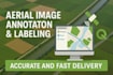
Do you have aerial or satellite images that need precise labeling, annotation, or digitization? Look no further! Im a GIS specialist with hands-on experience using QGIS to create accurate and detailed labels for various use cases from land use classification and infrastructure mapping to object detection datasets for AI/ML.
What I Offer:
Use Cases:
I prioritize precision, timely delivery, and clear communication. Lets make your aerial imagery data-ready!
Quality work is my first Priority
Level 1
Languages
What types of features can you label?
I can label roads, buildings, rivers, trees, parking lots, farmland, and any specific features you request.
Can you provide the data in a specific coordinate system?
Absolutely! Just let me know your preferred CRS (e.g., WGS84, UTM).
What if I’m not satisfied with the result?
I offer revisions in all packages to ensure you're completely satisfied.
