Browse categories
English
$
USD
Connect to your AI

Level 2
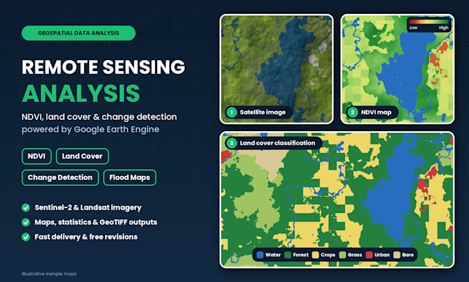
I turn satellite imagery into clear maps and answers using Google Earth Engine. Whether you need to see how land has changed, how healthy crops are, or where a flood hit, I deliver analysis you can use in a report, thesis or project.
What I do:
NDVI, EVI and vegetation health maps
Land use / land cover classification
Change detection between dates
Flood, drought and burned-area mapping
Urban growth and time-series analysis
What you get:
Final maps (PNG/PDF)
GeoTIFF or shapefile outputs
Area statistics (CSV/Excel)
Earth Engine script (Premium)
Data: Sentinel-2, Landsat, MODIS and more.
Send me your area (KML or shapefile), the dates and what you want to find out. Not sure which analysis fits? Message me first and I'll suggest one.
GIS Analyst, Mapping, Spatial Analysis and Data Visualization
Level 2
Languages
Which satellite data do you use?
Mostly Sentinel-2 and Landsat, and MODIS or other sources when they suit the project. I pick the best data for your area, dates and the detail you need.
Do I get the Earth Engine code?
Yes, it is included in the Premium package. For Basic and Standard you can add the script as an extra.
Can you analyze any location in the world?
Yes, as long as good satellite data exists for your dates. Heavy cloud cover can limit some regions, and I will tell you before starting if that is a problem.
How accurate are the results?
It depends on the data quality and the classes you need. The Premium package includes an accuracy assessment, so you can see how reliable the results are.
Can you help with my thesis or research?
Yes. I provide the maps, data and a clear summary of the method. I don’t write your thesis, and you should follow your institution’s rules on outside help.
