Browse categories
Explore
Fiverr Pro
English
$
USD


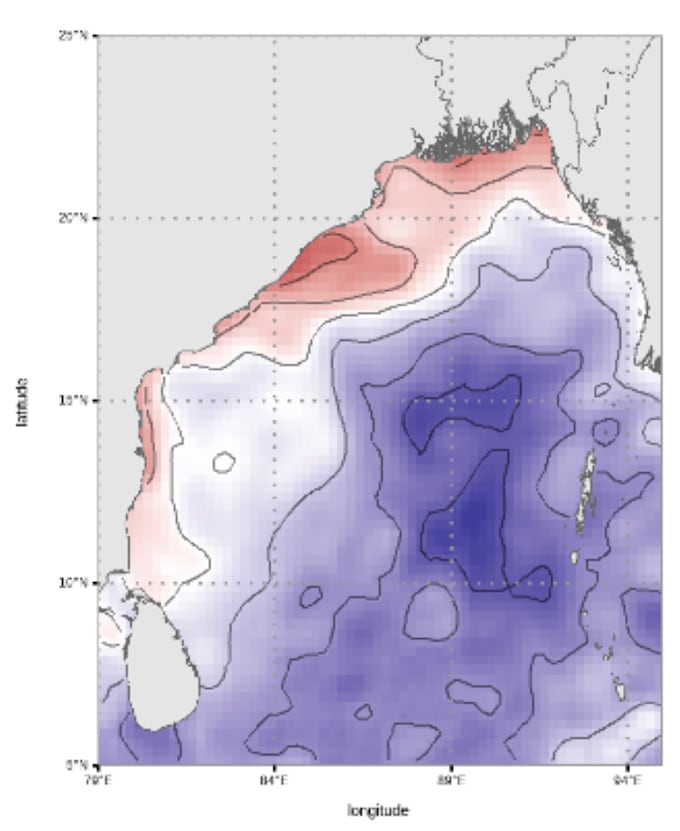
️ Transform Your Data into Beautiful, Insightful Maps with R & Python
Do you have location-based or tabular data that you'd like to visualize on a map?
I specialize in turning raw data into custom, high-quality maps using R and Python, perfect for research, presentations, reports, websites, and more.
What I Offer:
Perfect For:
Tools I Use:
Just send me your data and mapping goals Ill take care of the rest and deliver a map that makes your data speak!
GIS, Remote sensing and Data science
Languages
What type of data do you accept?
I can work with a variety of data formats, including CSV, Excel, shapefiles (SHP), NetCDF, and text files. If your data has spatial information (coordinates or regions), I can map it.
Can you create both static and interactive maps?
I primarily use R (ggplot2, sf, tmap) and Python (geopandas, matplotlib, plotly, folium) to transform data into maps.
What kind of maps can you create?
I offer a range of maps including: Choropleth maps Heatmaps Point/marker maps Custom region-based visualizations Thematic and statistical maps
Will you help clean or prepare the data if needed?
es! I offer basic data cleaning and formatting to ensure your data is ready for mapping. For complex datasets, please message me first.
Can I use these maps in academic papers or professional reports?
Definitely. I deliver publication-quality visuals suitable for journals, reports, theses, and presentations.