Welcome to my Gigi will digitize Topographic sheets, Satellite Imagery or other images/map in Arcgis
i will
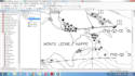
- Geo reference
- Digitize your raster data to convert it into vector form
- will submit the vector file in the following formats. shapefiles, Geodatabase,Kml,Kmz,Eps,Ai etc
- Create clear professional map
i will do work to provide you 100% satisfaction
Price is negotiable
Before placing an order ping me!
Thanks
Best Wishes!!!
Nomi