I will georeference maps and digitize gis data in arcgis and qgis

N
nurjohns
N
nurjohns
nurjohns

About this gig

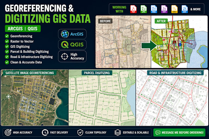
I will georeference maps, plans, satellite imagery and scanned documents using ArcGIS and QGIS.


Services:

Georeferencing

Raster to vector conversion

GIS digitizing

Parcel digitizing

Road digitizing

Building digitizing

Data cleanup


Supported formats:

PDF

JPG

PNG

TIFF

DWG

DXF


Please contact me before placing a large order.

Get to know nurjohns

nurjohns
  • FromKazakhstan
  • Member sinceSep 2021
  • Avg. response time1 hour
  • Last delivery1 day
  • Languages

    English, Russian, Kazakh
GIS and CAD specialist with experience in AutoCAD, ArcGIS, QGIS and spatial data processing. I work with CAD to GIS conversion, map creation, georeferencing, digitizing, spatial analysis and technical drawings. I can convert PDF or scanned drawings into editable AutoCAD files and prepare GIS datasets for planning and cadastral projects. Skills: • AutoCAD • ArcGIS • QGIS • GIS Mapping • CAD to GIS Conversion • Spatial Data Processing • Technical Drawings I focus on accurate work, clear communication and meeting project deadlines.

My Portfolio