Browse categories
Explore
Fiverr Pro
English
$
USD




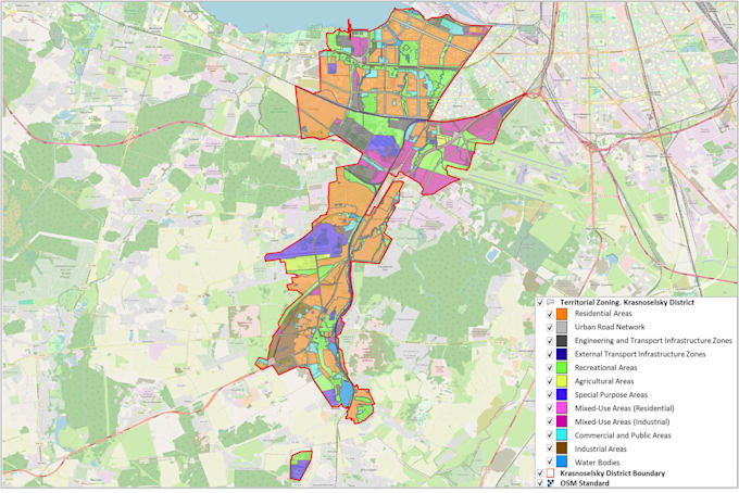
I will create a professional thematic GIS map in QGIS using your data or public geospatial datasets for scientific research, engineering, business, urban planning, environmental and transportation projects, reports, presentations, and publications.
I create Choropleth, Heat, Dot Density, Proportional Symbol, Graduated Symbol, Categorical, Population, Environmental, Transportation, Infrastructure, Land Use, Statistical, and Analytical maps.
Services:
Data formats:
SHP, GPKG, GeoJSON, KML/KMZ, CSV, Excel, DEM, raster data, PDF, PNG, SVG, and more.
Data sources:
Your data, public geospatial datasets (e.g., OpenStreetMap (OSM), SRTM), official government and municipal geospatial resources, and more.
Please contact me before ordering to choose the right package or request a custom offer.
GIS Specialist, Cartographer
Languages
What data do you need to start?
I need your project requirements and any available data. This may include GIS files, spreadsheets (Excel/CSV), shapefiles, coordinates, or other project materials. If you don't have data, I can help find suitable public datasets.
What file formats do you deliver?
I can deliver QGIS projects, SHP, GPKG, GeoJSON, KML/KMZ, PDF, PNG, SVG, and other formats upon request.
What spatial analysis methods and tools do you use?
I use QGIS tools for buffer, overlay, intersection, proximity, density, interpolation, raster, terrain, network, and other spatial analyses depending on your project requirements.
Do you work with terrain and elevation data?
Yes. I work with DEMs, DSMs, raster and vector data, terrain analysis, elevation models, contours, hillshade, slope maps, and both 2D and 3D terrain visualization in QGIS and Blender.
Do you create custom offers?
Yes. If your project doesn't fit one of the packages, please message me before ordering and I'll prepare a custom offer.
I'm not sure if my project can be solved with GIS. Can I contact you first?
Absolutely! If your project involves maps, locations, coordinates, spatial or geographic data—or you simply think GIS might help—feel free to message me. I'll review your project, discuss possible solutions, and recommend the best approach before you place an order.