Browse categories
Explore
Fiverr Pro
English
$
USD


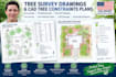
Are you an architect, engineer, or land developer trying to secure municipal building permits?
Stop wasting hours trying to calculate Root Protection Areas (RPAs) or wrestling with complex canopy layers in CAD. I will take your raw field data, GPS points, or topographical survey details and transform them into clean, engineering-ready, and council-compliant Tree Constraints Plans (TCP).
I strictly adhere to standard planning workflows (including US municipal codes, UK BS5837:2012, and Australian AS4970 standards) to ensure your design drawings breeze through environmental reviews.
Fiverr does not screen freelancers in this category. Please verify qualifications and discuss requirements with the freelancer before ordering, including any preferences regarding the use of AI tools.
Tree Survey and CAD Drafter Arboricultural Reports Data Mapping
Languages
What regulatory design standards do you follow for the RPAs?
I default to calculating the Root Protection Area according to standard urban planning guidelines (e.g., the 12x trunk diameter multiplier for US zones or BS5837 standards for UK projects). If your city has an unusual localized radius multiplier, just let me know!
Can you work with hand-drawn site sketches?
Yes! As long as your sketch includes approximate distances, structural boundaries, and basic trunk measurements, I can vectorize and scale it properly in AutoCAD.
Do you conduct on-site physical tree inspections?
No. This is a remote, specialized CAD mapping and layout service. You provide the raw field metrics, site dimensions, or surveyor topo notes, and I turn them into professional engineering layers.
