Browse categories
Explore
Fiverr Pro
English
$
USD




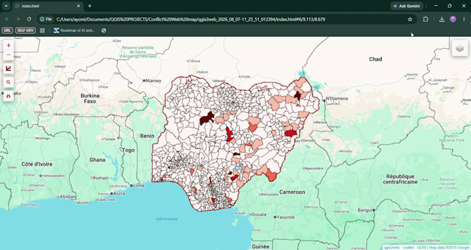
I offer professional GIS mapping, spatial data analysis, and WebGIS development tailored to your project needs. Whether you need custom interactive web maps, spatial data visualization, route optimization, or complex spatial analysis, I deliver accurate and high-quality results using industry-standard tools like QGIS, ArcGIS, Python, and modern web mapping libraries.
What I Offer
Why Choose This Service
Feel free to message me before placing an order so we can discuss your project scope and choose the best setup for your needs.
GIS Specialist, GIS Developer, Spatial analyst
Languages
What details or data do I need to provide before starting?
Please provide your source data (e.g., Shapefiles, GeoJSON, CSV, Excel with coordinates, or spatial coordinates), project requirements, and any specific preferences for map styling, color schemes, or layout formats.
Which GIS software and tools do you use?
I work with industry-standard tools including QGIS, ArcGIS Pro, Python (GeoPandas, Folium, Shapely), PostgreSQL/PostGIS, and JavaScript libraries (Leaflet, Mapbox) for WebGIS projects.
What format will I receive my final deliverables in?
Deliverables depend on your project needs. They can include high-resolution map images (PDF, PNG, JPG), spatial vector data (Shapefile, GeoJSON, KML), standalone HTML files for interactive web maps, or source code for custom scripts.
Can you build interactive web maps that I can embed on my website?
Absolutely. I develop interactive WebGIS dashboards and maps that can be embedded directly into your website or hosted online for user interaction.
Should I contact you before placing an order?
Yes, please send a message first. Discussing your requirements beforehand ensures we choose the right package, define clear expectations, and avoid unnecessary order delays.
Can you work with incomplete or raw spatial data?
Yes. I can clean, format, geocode, and structure raw address or coordinate data to make it ready for spatial analysis and mapping.