Browse categories
Explore
Fiverr Pro
English
$
USD


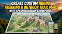

Hello there, welcome to my gig! Are you looking for a professional and easy to read hiking, trekking, or outdoor trail map?
I can create a custom trail map based on your GPS data, route, location, or specific requirements. Whether you need a map for a hiking trail, trekking route, outdoor adventure, tourism business, park, travel guide, or personal project, I will turn your route information into a clear and professional map.
My custom maps can include:
I can work with GPS files and other location or route information you provide, and I will make sure the final map is clear, attractive, and practical to use.
Whether you need a simple hiking route map or a detailed outdoor trail map, I will create a professional design tailored to your needs.
Please contact me before placing an order if your project involves multiple routes, large areas, complex GPS data, or specific mapping requirements.
Please inform the freelancer of any preferences or concerns regarding the use of AI tools in the completion and/or delivery of your order.
professional map expert
Languages
What do you need from me to get started?
I will need your GPS file, route information, location, or any available map data. You can also provide the details you want included, such as landmarks, waypoints, names, distances, elevation, logos, or specific design preferences.
What GPS file formats can you work with?
I can work with common GPS and mapping formats such as GPX, KML, and KMZ. If you are unsure whether your file is suitable, feel free to contact me before ordering.
Can you create a map from a location without a GPS file?
Yes. If you don't have a GPS file, send me the location, route details, coordinates, or available reference information. I can let you know what is possible based on the information provided.
Can you create maps for multiple hiking or trekking routes?
Yes. I can create maps containing multiple routes, trails, waypoints, and other important features. For larger or more complex projects, please contact me first for a custom offer.
Can you include elevation and distance information?
Yes. Depending on the available GPS or mapping data, I can include route distance, elevation information, elevation profiles, waypoints, and other useful trail details.
Can I request a specific map style?
Yes. You can provide your preferred colors, style, reference map, branding, logo, icons, or other design requirements. I will create the map to match your desired look as closely as possible.
Can you create maps for commercial use?
Yes. I can create custom trail maps for hiking companies, tour operators, tourism businesses, outdoor organizations, publications, websites, and other commercial projects.
Can you edit or update an existing trail map?
Yes. If you already have a map that needs route changes, additional trails, updated information, new landmarks, or a design refresh, send it to me and I can review the requirements.
What file formats will I receive?
Depending on your package, I can provide high quality digital and print ready formats such as PNG, JPG, and PDF. Other formats can be discussed before ordering.


