Browse categories
Explore
Fiverr Pro
English
$
USD


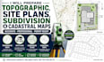
Welcome to my expert land surveying and mapping service!
I am an experienced land surveyor with a bachelors degree in land surveying , specializing in delivering accurate and high-quality topographic maps, site plans, subdivision layouts, and cadastral maps for residential, commercial, and infrastructure projects.
Services Offered:
Why Choose Me?:
Deliverables:
High-quality, detailed maps in PDF, DWG, or DXF format
Clear, accurate measurements and layouts.
PLEASE MESSAGE BEFORE MAKING AN ORDER FOR REQUIREMENTS
(Autocad,survey,land,land surveying,land survey,surveying,drawing,gis mapping,landscape,map,architecture,civil engineering,sitemap,microsoft excel,survey plan,2d plan,google maps,dem,digitization,spatial analysis,georeferencing,subdivision,autocad civil 3d,contour,topographic)
Fiverr does not screen freelancers in this category. Please verify qualifications and discuss requirements with the freelancer before ordering, including any preferences regarding the use of AI tools.
professional architect and civil structural engineer
Languages
