Browse categories
Explore
Fiverr Pro
English
$
USD



hello and welcome!
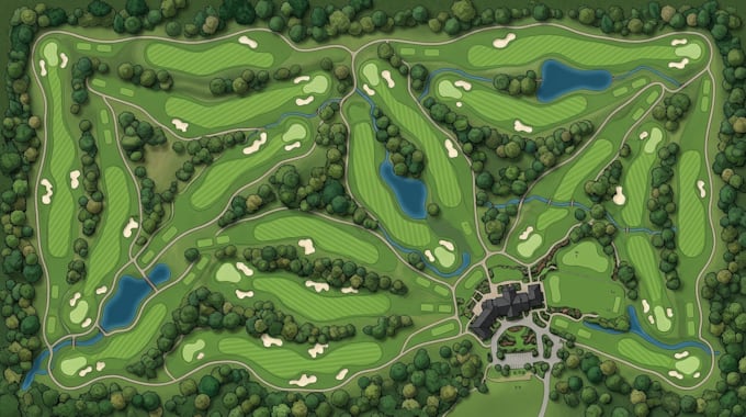
Professional Illustrated Golf Course Maps for Clubs, Resorts and Tournaments
I design custom illustrated golf course maps that present your course clearly and professionally. Each map is tailored to your layout, preferred style, and intended use.
my services include;
Why work with me?
I focus on clean layouts, balanced colors, readable labels, and carefully arranged details. Your map will be designed around your supplied references and branding, making it suitable for your club, resort, or promotional materials.
What you will receive:
Please send your existing course map, aerial reference, sketch, or layout before ordering.
Please inform the freelancer of any preferences or concerns regarding the use of AI tools in the completion and/or delivery of your order.
professional map designer
Languages
Q: What do you need to start?
A: Please provide your existing course map, aerial image, Google Earth reference, sketch, or other layout information.
Q: Can you design a complete 18-hole golf course map?
A: Yes. Select the Premium package or contact me with your course details for a custom quote.
Q: Can you match my golf club's branding?
A: Yes. Share your preferred colors, logo, typography, and any existing design guidelines.
Q: Which file formats do you deliver?
A: PNG and PDF are available as specified in your package. Editable vector formats can be included when agreed before ordering.
Q: Can the map be used for printing and signage?
A: Yes. Please provide the intended print size and use so the layout and export settings can be prepared appropriately.
Q: Can you work from an old or low-quality map?
A: Yes, if the available references contain enough information. Please send them first so I can confirm the scope and accuracy possible.