Browse categories
Explore
Fiverr Pro
English
$
USD


Hello
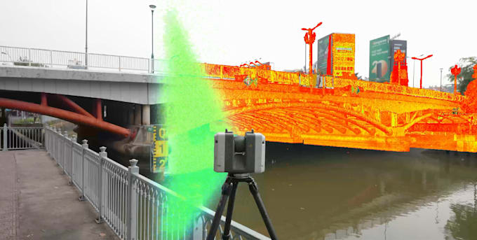
I specialize in professional processing of 3D terrestrial laser scan and drone based point cloud data, delivering clean, optimized, and well structured datasets ready for Autodesk ReCap and BIM environments.
My service focuses on transforming raw scan data into accurate and usable point clouds for AutoCAD, Revit, Civil 3D, and other CAD, BIM software. Whether your data comes from ground based laser scanners or UAV drone photogrammetry, I handle the entire processing pipeline with precision and care.
Services Included:
Preparation of point cloud data for BIM workflows
Large files are supported, with secure cloud based file transfer available.
If your project has specific technical requirements or large scale scan data, feel free to reach out. I am happy to review your data and provide a reliable, efficient solution tailored to your project.
Fiverr does not screen freelancers in this category. Please verify qualifications and discuss requirements with the freelancer before ordering, including any preferences regarding the use of AI tools.
Geomatics Expert
Languages
1. What type of laser scan data do you work with?
I work with terrestrial laser scanning and LiDAR point cloud data from Leica, Trimble, FARO, etc, and UAV-based LiDAR systems.
2. What services are included in your laser scan processing?
Services include point cloud registration, alignment, noise removal, cleanup, optimization, and preparation for further CAD or BIM use.
3. Can you register and align multiple scan stations?
Yes. I perform accurate registration and alignment of multi-station terrestrial laser scans and UAV LiDAR datasets.
4. Do you clean noise such as people, vehicles, and moving objects?
: Yes. I remove unwanted points including people, vehicles, vegetation noise, reflections, and scan artifacts.
5. What file formats do you accept and deliver?
I support E57, LAS, LAZ, PTS, PTX, XYZ, FLS, TZF, RCP, and other common point cloud formats.
6. Do you create Autodesk ReCap projects?
Yes. I can deliver well-structured Autodesk ReCap projects with organized scans and optimized performance
7. Can you handle large or complex scan datasets?
Yes. I regularly work with large-scale projects, including industrial sites, infrastructure, and terrain scans.
8. How do you transfer large point cloud files?
Secure cloud-based file transfer is available via Google Drive, Dropbox, OneDrive, or other platforms as needed.
9. Are your point clouds ready for CAD or BIM teams to use?
Yes. While I do not create models, the processed point clouds are clean, aligned, and ready for CAD or BIM workflows.
10. Should I contact you before placing an order?
Yes. Please contact me first so I can review your scan data and confirm the best workflow for your project.