Browse categories
Explore
Fiverr Pro
English
$
USD


You will be working with a UAV Photogrammetry and LiDAR specialist who has strong hands-on experience, from field data acquisition to final data processing and analysis. I support clients in surveying, construction, infrastructure, and GIS projects.
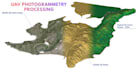
My service focuses on delivering accurate and reliable outputs such as orthomosaics, point clouds, DSM, DEM, 3D Mesh and contour lines. All deliverables are clean, properly georeferenced, and ready for direct use in CAD, GIS, or engineering workflows.
As a licensed and experienced UAV pilot operating multiple drone platforms and sensors, I understand image quality, flight conditions, and sensor limitations. This practical field experience allows me to optimize processing workflows and apply strict quality control to every project.
I work with a high level of responsibility, clear communication, and fast turnaround times. I would be very happy to collaborate with you and support your projects with reliable and professional result
Geomatics Expert
Languages
1. What data do you need to start the project?
I need raw UAV images (JPG/TIFF), flight logs if available, and GCPs (optional but recommended).
2. What UAV data formats do you accept?
I accept images from DJI, Autel, senseFly, and most professional UAV platforms.
3. Do I need Ground Control Points (GCPs)?
GCPs are optional but highly recommended for higher accuracy in DEM and contour outputs.
4. What outputs will I receive?
You can receive orthomosaic, DEM, DSM, point cloud, and contour lines in standard GIS/CAD formats.
5. What file formats do you deliver?
Common outputs include GeoTIFF, LAS/LAZ, DWG, DXF, SHP, and PDF.
6. What software do you use for processing?
I use professional software such as Agisoft Metashape, PIX4D, DJI Terra, and ArcGIS Pro.
7. What accuracy can I expect from the results?
Accuracy depends on flight height, overlap, camera quality, and GCP usage. I always aim for survey-grade results.
8. Can you handle large or complex projects?
Yes, I have experience processing large-scale and complex UAV datasets for infrastructure and terrain projects.
9. Do you provide contour lines at custom intervals?
Yes, contour intervals can be customized based on your project requirements.
10. Can you review my data before ordering?
Absolutely. You can send sample data and I will review it before you place an order.


