Browse categories
Explore
Fiverr Pro
English
$
USD

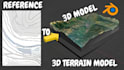
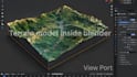
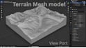
Have a location, landscape, or map you want to see as a real 3D model? Thats where I come in.
I create custom 3D terrain maps, topographic models, relief maps, elevation maps, contour maps, and STL terrain models from real world locations and your provided references.
Whether its a mountain range, a coastline, a city area, a hiking route, or a landscape you simply want to turn into a physical model, I can build the terrain with the right elevation, slopes, valleys, and landform details.
I can help with:
You can send me a location, map, screenshot, reference, or terrain data, and we can work from there. Ill create the model according to your required size, detail, and output format.
Have a terrain project in mind? Send it over and lets see what we can build.
Please inform the freelancer of any preferences or concerns regarding the use of AI tools in the completion and/or delivery of your order.
High Detail 3D Designer for Terrain and Manufacturing
Languages
Can you create terrain from a specific location?
Yes. Send me the location, map, coordinates, reference, or terrain data, and I can create a custom 3D terrain model from it.
I only have a 2D map. Is that enough?
Yes. A 2D map can be used as a starting reference. If elevation or terrain data is needed, you can provide it or I can work from suitable available data.
Can you make the terrain ready for 3D printing?
Yes. I can prepare the terrain as an STL model and optimize the geometry for physical 3D printing based on your required size and level of detail.
Can you include features like roads, rivers, buildings or coastlines?
Yes. I can add relevant landscape or map features depending on the project, including roads, rivers, buildings, coastlines, and other requested elements.
What do you need from me before starting?
Send whatever you already have location, map, screenshot, reference, dimensions, terrain data, preferred file format, and any specific details you want included. I can help determine what else is needed.


