Browse categories
Explore
Fiverr Pro
English
$
USD
GIS Developer, Hydrogeologist, Geoscience Developer
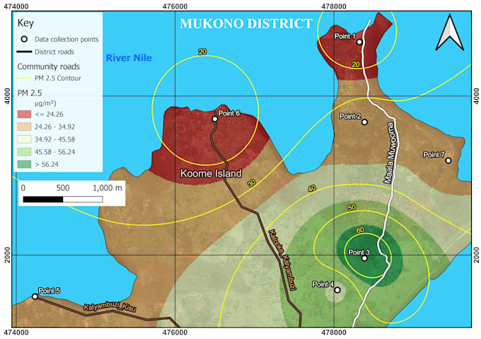
Need clean, accurate GIS maps or spatial analysis without the back-and-forth? I'm a Hydrogeologist and GIS Developer with hands-on experience in geospatial mapping, groundwater/watershed analysis, and Python-based GIS automation.
What I can do for you: Professional GIS maps (QGIS, ArcGIS Pro) for reports, presentations, or research Spatial data cleaning, formatting, and analysis (GeoPandas, GeoJSON, SQL) Remote sensing analysis using Google Earth Engine Python scripts to automate repetitive GIS workflows Hydrogeological/watershed mapping, borehole siting support, aquifer data visualization Recent work includes GIS support for the Kampala Population Equivalent Project (SANDEC EAWAG), hydrogeological mapping for infrastructure planning, and developing HYDRO_SYNC, an open-source platform for digitizing field data collection. I care about accuracy and clear communication I'll ask questions upfront rather than guess, so you get a deliverable that actually works for your project the first time.
Send me your data or requirements and I'll get started. Happy to do a quick scoping chat before you order if you're not sure which package fits.


What file formats can you work with?
Shapefiles, GeoJSON, KML, CSV/Excel with coordinates, and raster formats (GeoTIFF). I can also convert between formats as part of the job.
I don't have clean data yet — can you still help?
Yes. Data cleaning and structuring is part of my process, not an extra step — just send what you have and I'll assess it in the Initial Data Audit.
Do you offer revisions?
Yes, reasonable revisions are included so the final map or analysis matches what you need — just outline any changes clearly.