I will make professional maps and layouts

P
puujeers
P
puujeers
Puujee Rs

Level 1

About this gig

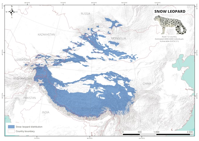
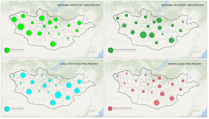
I am GIS and Remote sensing professional with 10 years of background. If you have request that is more complicated than a simple map, I will advice you to consult with me and describe to me what geospatial tasks that you wanted to be done. I am able to work on bigger projects such as geospatial analyses, remote sensing and big scale screen-digitizing.

Get to know Puujee Rs

Puujee Rs
5.0(21)

Level 1

  • FromMongolia
  • Member sinceJun 2017
  • Avg. response time3 hours
  • Last delivery1 week
  • Languages

    English, Mongolian
Remote Sensing and GIS is my profession, and I am so good at that. Arcgis, Arcmap expert. ENVI, ERDAS, ILVIS intirmidate level. GIS and Remote sensing skills : Making and reading map, layout, spatial analysis, zonal analysis. Screen digitizing, Raster and vector conversion. Conversion between formats (*.cad, *.shp, *.kml, *.kmz, *.jpg, *.kmz, *.tiff ...etc)