Browse categories
Explore
Fiverr Pro
English
$
USD

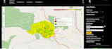
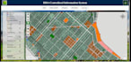
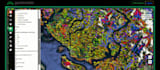
Need an expert GeoInformatics Engineer to build powerful Web GIS applications, interactive maps, or robust spatial databases?
I'm a professional GeoInformatics graduate with 7 years of experience specializing in GIS programming, spatial data analysis, and full-stack Web GIS development.Whether you need a dynamic dashboard, a custom QGIS plugin,or an enterprise PostGIS setup, I deliver scalable solutions.
Core Services:
WebGIS Apps: Full-stack builds using Django/GeoDjango, Node.js, & React.
Interactive Maps: Custom responsive mapping via Leaflet, Mapbox, & Folium.
3DGIS Visualization: Immersive spatial solutions using Cesium & Three.js.
Spatial Databases: Advanced queries & management using PostGIS & PostgreSQL.
Automation & Plugins: Custom QGIS plugin development & Python GIS programming.
Data Science: Processing spatial data using GeoPandas, Rasterio, & Sklearn.
️ Tech Stack:
Python, JavaScript, React, Django, GeoServer, Leaflet, Mapbox, ArcGIS, QGIS, PostGIS.
Why Me?
7+ years of engineering experience delivering clean, scalable code from database architecture to front-end UI design.
️ NOTE: Please message me BEFORE placing an order to discuss your data files & project.
GeoInformatics Specialist and Environmental Data Analyst
Languages
What do I need to provide before placing an order?
Please provide your project requirements, target goals, and any existing spatial data files you have (such as Shapefiles, GeoJSON, KML, or CSV coordinates). If you need an enterprise Web GIS application or database integration, sharing your preferred tech stack (e.g., Django, React, PostGIS) is high
Which mapping libraries and web frameworks do you specialize in?
I build custom Web GIS applications using modern frameworks like Django (GeoDjango), Node.js, and React. For frontend interactive maps, I specialize in Leaflet js, Mapbox, Folium, and OpenLayers, as well as Cesium and Three.js for immersive 3D GIS data visualizations.
Can you handle spatial database management and geoprocessing tasks?
Absolutely. I have deep expertise in building, optimizing, and managing relational spatial databases using PostGIS and PostgreSQL. I handle complex SQL spatial queries, database design, and automated backend geoprocessing pipelines using Python libraries like GeoPandas.
Will you host or deploy the completed interactive web map or application?
I will deliver the clean, fully documented source code files ready for deployment. If required, I can also assist you in deploying your Web GIS application to hosting platforms like GitHub Pages, Netlify, AWS, or your local server environment as an extra service.
Do you develop custom desktop GIS tools or QGIS plugins?
Yes, I provide custom GIS programming services. I can write standalone Python scripts for automated spatial data analysis or develop fully functional, tailored QGIS plugins to optimize and accelerate your specific desktop workflow.


