Browse categories
Explore
Fiverr Pro
English
$
USD

Level 2


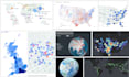
I am a Python mapping, data visualization and GIS expert specializing in customized maps using Plotly, Mapbox, Folium, ArcGIS Pro, QGIS and other tools. I can help you create stunning, informative, and interactive maps for storytelling, data exploration, research, and presentations.
Here's what I offer:
Projection Maps: World maps, country maps, thematic maps, categorical maps, regional maps, time slider maps, maps with points, spikes, filters, and more.
3D Maps: Point maps, animated points, growing points, 3D heatmaps, extruded regions, satellite maps, and hex maps.
Marker Maps: City-level maps, locator maps, store finders, photo markers, emoji markers, custom popups, and crime maps.
3D Globe Maps: Simple globes, rotating globes, animated markers, colored/glowing point globes.
Other Custom Maps: Arc maps, connection maps, import/export maps, flow maps, trade routes, custom topographic overlays.
These maps are perfect for dashboards, reports, websites, academic work, urban studies, or business insights. These maps are embeddable in websites, Canva, and more, shared easily via a single link.
Message me before placing order.
#interactivemaps #maps #mapdesign
Data Analysis, Data Visualization, Data Animation, GIS, Remote Sensing, Python
Level 2
Languages
| (3) | ||
| (0) | ||
| (0) | ||
| (0) | ||
| (0) |

galaxus24com
Repeat Client

Germany
Rakib has once again proven himself to be a true professional in his field – and, moreover, a highly skilled developer in programming and coding. Many thanks for the excellent work, and I look forward to our continued collaboration on the next project... Best regards from Germany H.C.
Up to $50
Price
3 days
Duration

Seller's Response
galaxus24com
Repeat Client
Germany
Rakib did a great job again today, and as always very quickly and professionally, thank you. Best regards from Germany H.C
Up to $50
Price
2 days
Duration
afzal87990

Saudi Arabia
Rakib did an amazing job, the data was understood well and executed as per my expectations
$50-$100
Price
5 days
Duration
| (3) | ||
| (0) | ||
| (0) | ||
| (0) | ||
| (0) |
galaxus24com
Repeat Client
Germany
Rakib has once again proven himself to be a true professional in his field – and, moreover, a highly skilled developer in programming and coding. Many thanks for the excellent work, and I look forward to our continued collaboration on the next project... Best regards from Germany H.C.
Up to $50
Price
3 days
Duration
Seller's Response
galaxus24com
Repeat Client
Germany
Rakib did a great job again today, and as always very quickly and professionally, thank you. Best regards from Germany H.C
Up to $50
Price
2 days
Duration
afzal87990
Saudi Arabia
Rakib did an amazing job, the data was understood well and executed as per my expectations
$50-$100
Price
5 days
Duration


