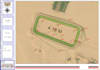
I will create civil 3d topographic maps, contour lines, and earthwork volumes

R
ramzi_alhakimi
R
ramzi_alhakimi
Ramzi Alhakimi

About this gig

Welcome to my professional Civil 3D & Surveying gig!

Are you looking for accurate and high-quality topographic mapping or earthwork calculations? With over 13 years of practical experience as a Senior Civil Engineer and Land Surveyor, I specialize in transforming raw survey data into precise engineering deliverables.

My Services Include:

  • Importing survey points (CSV, TXT, XYZ) into AutoCAD Civil 3D.
  • Creating accurate 3D TIN Surfaces (Existing & Proposed).
  • Generating precise Contour Lines with labels.
  • Earthwork Volume Calculations (Cut and Fill reports).
  • Creating Longitudinal Profiles and Cross-Sections.
  • Road Alignment and Corridor modeling.

Why Choose Me?

  • 13+ years of real-world infrastructure and surveying experience.
  • High attention to detail and engineering standards.
  • Quick turnaround time and clear communication.

Deliverables: You will receive the native DWG/Civil 3D file, along with PDF layouts and Excel volume reports (depending on your package).

️ Please contact me BEFORE placing an order to discuss your project requirements, coordinate system, and input data so I can provide the best custom offer for you.

Service verification and delivery style preference

Fiverr does not screen freelancers in this category. Please verify qualifications and discuss requirements with the freelancer before ordering, including any preferences regarding the use of AI tools.

Get to know Ramzi Alhakimi

Ramzi Alhakimi

Senior Civil 3D GIS Specialist

  • FromYemen
  • Member sinceSep 2026
  • Avg. response time1 hour
  • Languages

    English, Arabic
I am a Civil 3D, land surveying, road design, and GIS specialist with over 17 years of practical experience in engineering surveying, topographic mapping, and infrastructure projects. I provide professional services using Autodesk Civil 3D, AutoCAD, ArcGIS Pro, Google Earth, and GNSS survey data. My services include road alignments, profiles and cross-sections, TIN surfaces and contours, survey point processing, cut-and-fill calculations, earthwork quantity reports, GIS mapping, georeferencing, coordinate system management, cadastral mapping, and map digitization.

My Portfolio