I will prepare maps for ec and eia emp wildlife clearance reports

R
ravi_jatav415
R
ravi_jatav415
Ravi J

About this gig

Are you an environmental consultant, EPC contractor, or project proponent looking for accurate, MoEF&CC-compliant GIS maps for Environmental Clearance (EC) or EIA reports & Wildlife Clearance?


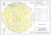
I am a professional GIS specialist with hands-on experience of 5 plus years in preparing EC / EIA / ToR maps for infrastructure, mining, industrial projects.

I prepare precise, scale-accurate, and report-ready GIS Maps as per Indian regulatory standards.


Maps I offer in this Gig-


  1. Key Plan (Buffer Zone of 10km)
  2. Corner Coordinate Map
  3. Environment Setting Map (Buffer Zone of 10km)
  4. Location Map (Buffer Zone of 10km)
  5. Sampling/Monitoring/Baseline Maps (Buffer Zone of 10km)
  6. DEM Elevation Map (Buffer Zone of 10km)
  7. Contour Map (Buffer Zone of 10km)
  8. Landuse/landcover (LULC) Map (Buffer Zone of 10km)
  9. Location Map for Forest Authentication (Buffer Zone of 10km)
  10. Geology & Geomorphology Maps (Buffer Zone of 10km)


Note- Buffer Zone/Study Area will be consider as per your requirements.


Delivery style preference

Please inform the freelancer of any preferences or concerns regarding the use of AI tools in the completion and/or delivery of your order.

Get to know Ravi J

Ravi J
  • FromIndia
  • Member sinceDec 2025
  • Languages

    English, Hindi
I’m a GIS Specialist with over 5.5 years of experience in geospatial analysis, toposheet preparation, and georeferencing using ArcGIS, QGIS, and AutoCAD Maps. I help clients create accurate, professional maps for land use planning, infrastructure development & urban mapping. ✅ Toposheet Digitization ✅ Georeferencing Maps & Satellite Imagery ✅ Feature Extraction & Thematic Mapping ✅ ArcGIS, QGIS, Global Mapper, AutoCAD ✅ Shapefile/KML/GeoJSON Editing & Conversion ✅ Spatial Analysis, Land Use Maps, I’m committed to delivering precise and high-quality GIS outputs, tailored to your project needs