Browse categories
Explore
Fiverr Pro
English
$
USD

Welcome to My GIS World!
I am Retegui a GIS & Remote Sensing specialist with over 8 years of international experience helping clients across real estate, environment, infrastructure, and agriculture make smarter, location-based decisions.
Lets bring your geospatial ideas to life!
Automate Your Trades Maximize Your Edge
Languages
Can you deliver GIS files in KMZ, KML, SHP, or GeoTIFF formats?
Yes! I can export your maps and spatial data in any standard GIS format, including KMZ, KML (for Google Earth), Shapefiles, GeoTIFFs, and CSV. Just let me know what your workflow requires.
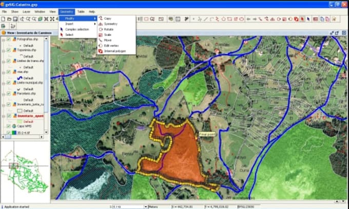
Do you work with QGIS or ArcGIS Pro?
Yes, I’m fully proficient in both QGIS and ArcGIS Pro, and I’ll tailor the deliverables based on your preferred platform.
Can you create maps for real estate or zoning analysis?
Absolutely. I’ve worked with real estate firms across the U.S., creating parcel maps, zoning overlays, suitability scoring, and flood risk assessments to support property decisions.
Do you offer support after delivery?
Yes! I provide support for revisions and file usage after delivery. If you need further customization or edits, I’m always open to follow-up work.
Do you process drone or satellite imagery (e.g. NDVI, LiDAR)?
Yes. I have hands-on experience with drone data (including Phantom 4 Multispectral) and satellite imagery (Sentinel, Pleiades, SPOT, etc.), and I provide NDVI maps, orthomosaics, DEMs, and LiDAR-based analysis.
Are you available for long-term or ongoing projects?
Yes! I regularly work with clients on long-term GIS and remote sensing projects — from monthly data updates to multi-phase spatial analysis. I’m open to both one-time tasks and strategic collaborations.
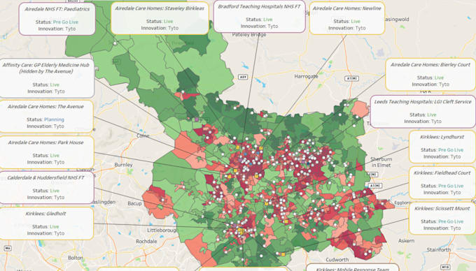
Can you build interactive web maps or dashboards?
Yes! I can develop interactive web maps using platforms like ArcGIS Online, Mapbox, Leaflet, or custom web apps, tailored to your needs. Whether it's for real estate, environmental monitoring, or internal company use, I can help you publish clean, dynamic maps that are easy to update or embed.