Services I Offer:
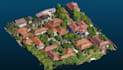
- Photogrammetry Processing: Aligning photos, building dense clouds, and generating 3D Mesh models.
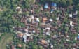
- Orthomosaic Generation: High-resolution 2D geo-referenced orthophotomaps (GeoTIFF).
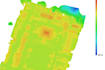
- Elevation Models: DEM, DSM, and DTM generation.
- Topographic Mapping: Contour line extraction and elevation mapping.
- Map Layout Design: Ready-to-print maps with grid, legend, and scale bar (PDF/JPG/PNG).
Why Choose Me?
- High accuracy with GCP (Ground Control Point) alignment support.
- Compatible with ArcGIS, QGIS, Agisoft Metashape, and Pix4D workflows.
- Fast delivery and clear communication.
What I Need From You:
- Raw aerial photos (JPG/TIFF).
- GCP data (if available).
- Specific project instructions/requirements.
Please contact me before placing an order to discuss your project details and custom needs!