Browse categories
Explore
Fiverr Pro
English
$
USD

Level 1

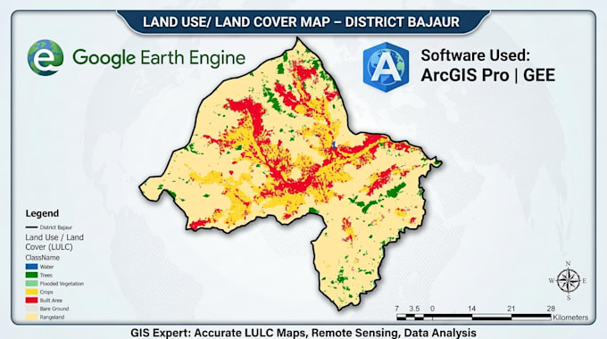
I am a Civil Engineer specializing in GIS, remote sensing, and water resources engineering with practical experience in spatial data analysis using Google Earth Engine (GEE) and ArcGIS Pro.
I provide professional GIS and satellite image processing services for environmental, hydrological, and land analysis projects.
Using advanced geospatial tools and satellite datasets, I can help you transform raw spatial data into meaningful maps and insights for decision-making.
Services I offer:
Data sources used:
Why choose me:
Civil Engineer, Hydraulic and Water Resources Design Expert
Level 1