Browse categories
Explore
Fiverr Pro
English
$
USD

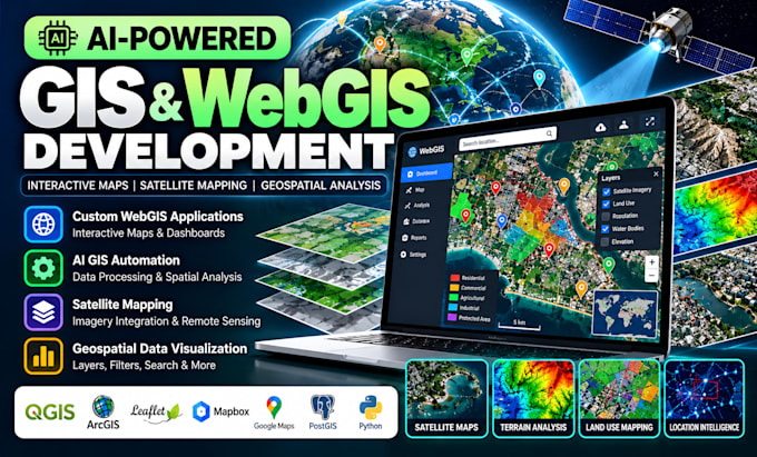
Need a custom WebGIS application, AI GIS automation, or interactive satellite mapping solution?
I help businesses, researchers, and professionals turn geographic data into useful insights through custom web mapping applications and geospatial tools.
WHAT I CAN HELP YOU BUILD:
WHAT YOU CAN EXPECT:
Whether you need a location intelligence dashboard, land-use mapping tool, interactive GIS platform, or automated geospatial workflow, let's discuss the best approach for your project.
READY TO GET STARTED?
Send me a message with your project goals, available data, and required features. I'll review your needs and recommend a suitable solution before you order.
Please contact me before order
WebGIS Developer
Languages
What GIS and WebGIS services do you offer?
I offer custom WebGIS development, interactive satellite maps, GIS automation, geospatial data visualization, spatial analysis, and AI-assisted mapping solutions tailored to your needs. Copy answer
Can you integrate satellite maps into my web application?
Yes, I can integrate suitable satellite basemaps and mapping services into your WebGIS application, depending on API access, licensing, and your project requirements.
Can you automate GIS tasks using AI or Python?
Yes, depending on your requirements, I can develop GIS automation workflows for geospatial data processing, repetitive mapping tasks, spatial analysis, and suitable AI-assisted operations.
What files or data do I need to provide?
Please share your project requirements and any available GIS datasets, such as Shapefiles, GeoJSON, GeoTIFF, or CSV files. If you do not have data, we can discuss suitable available sources.
Can you build a fully customized GIS application?
Yes, I can develop a customized WebGIS application based on your goals, required map layers, features, and budget. Please message me before ordering so we can agree on the scope and delivery timeline.