Browse categories
Explore
Fiverr Pro
English
$
USD
Professional GIS, AutoCAD, and Interactive Mapping Services
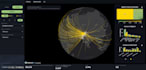
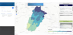
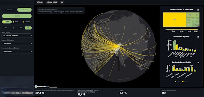
I offer professional development of interactive GIS web maps and dashboards designed to visualize, explore, and analyze spatial data effectively. Services include creation of dynamic web maps, thematic layers, indicators, and user-friendly dashboards that support decision-making and spatial insights.
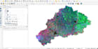
The work covers the full GIS workflow, from spatial data preparation to interactive visualization. Client-provided data such as shapefiles, GeoJSON, or tabular datasets can be transformed into clean, responsive web-based GIS solutions.
Suitable for planning, research, monitoring, and analytics projects, the dashboards are designed for clarity, performance, and usability. The focus is on delivering structured, reliable, and scalable GIS visualizations that can be extended or integrated with databases when required.