Browse categories
Explore
Fiverr Pro
English
$
USD


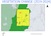
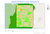


I help organizations, researchers, and consultants detect illegal mining activities and deforestation risks using GIS and satellite imagery.
I provide clear maps and reports highlighting potential environmental risks. My services are ideal for:
NGOs monitoring illegal mining and deforestation
ESG projects needing environmental risk analysis
Researchers studying land use changes
What I provide:
Detection of illegal mining activities (ASGM)
Identification of deforestation risks
Clear maps and reports (PDF/PNG)
Shapefiles for integration in GIS (Standard package)
Why choose me?
I combine mining engineering expertise with GIS and remote sensing skills to deliver actionable, reliable insights.
Bilingual Virtual Assistant,Video Editor ,Quality and Precision
Languages
What information do you need to start the analysis?
To start the project, I need the location of the study area (coordinates, shapefile, or a map screenshot). If available, you can also provide specific dates, satellite images, or any additional GIS data related to the area.
What type of data do you use for the analysis?
I use satellite imagery and GIS datasets such as land cover data, elevation models, and other spatial layers. The analysis is performed using professional GIS software including ArcGIS Pro.
What will I receive at the end of the project?
You will receive high-resolution maps (PDF/PNG), a professional report explaining the analysis and results, and for some packages, GIS files such as shapefiles or GeoTIFF that can be used in GIS software.
Can you analyze areas outside Africa?
Yes. I can perform GIS and satellite analysis for any location worldwide, as long as satellite imagery and spatial data are available.
How accurate is the detection of illegal mining or deforestation?
The analysis is based on satellite imagery and spatial analysis techniques. While it provides strong indications of potential mining activity or deforestation, field verification may be required for full confirmation.
Can you customize the analysis for my project?
Yes. I can adapt the analysis depending on your needs, including additional maps, larger study areas, or more detailed environmental analysis.


