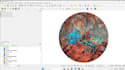
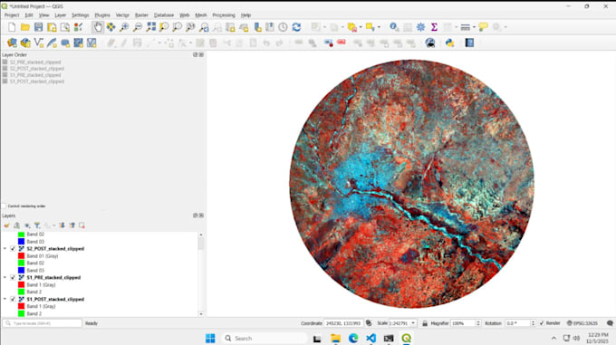
I provide Sentinel-1 and Sentinel-2 remote sensing and satellite data analysis services.
My work includes change detection, damage assessment, flood mapping, vegetation analysis (NDVI), land use/land cover mapping, SAR analysis, and time-based monitoring.
I deliver clear maps, GIS-ready outputs, and reliable analysis for research, planning, and professional projects. Some of the projects are:
- Sentinel-1 and Sentinel-2 satellite data analysis
- Change detection and before-after comparison
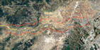
- Damage assessment for floods, fires, earthquakes, landslides, and other events
- SAR-based flood mapping (works under cloud cover and at night)
- Vegetation and crop health analysis (NDVI and related indices)
- Land use and land cover (LULC) classification and mapping
- Urban growth, construction, and land change monitoring
- Environmental and surface condition analysis
- Multi-date and time-series monitoring for long-term change analysis
- Raster processing, classification, and index calculation
- GIS-ready outputs including GeoTIFF, Shapefile, and GeoJSON
- Professional map layouts (PDF / PNG) with clear legends and interpretation
- Custom Sentinel-related remote sensing tasks based on project needs