Browse categories
Explore
Fiverr Pro
English
$
USD

1 order in queue


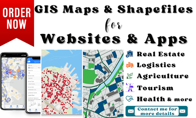
Unlock the full potential of your spatial data with my expert GIS services!
I specialize in creating high-quality GIS maps & shapefile layers, precise digitizing, and accurate georeferencing tailored for websites & apps using QGIS and ArcGIS Pro. With over 5 years of experience as a surveyor and GIS analyst, I guarantee top-notch results that meet your specific needs.
What do I offer?
Spatial analysis and create detailed GIS Maps
Digitizing scanned images & raster maps
Accurate georeferencing of maps and images
Remote Sensing
Why choose me?
Expertise in surveying & GIS mapping tools
High-quality & precise results in GIS maps, digitizing, and georeferencing
Excellent communication
Affordable prices
Whether you need GIS maps or GIS shapefile layers, digitizing, or georeferencing for your websites or apps related to real estate, logistics, agriculture, tourism, health, or any other sector, I am here to provide professional and efficient solutions. Let's collaborate to bring your spatial data to life!
ORDER NOW to get started on your GIS project with a GIS expert!
Message me anytime if you have any questions. I'm here to assist you!
Best Regards!
Rumesh
Graphic Designer, WebGIS Developer, GIS Analyst, eBay Top Rated Seller
Languages
What are the softawares you use?
I am using ArcGIS and QGIS software for the creation of shapefile layers for your websites or apps.
What is the process for creating GIS shapefile layers for my project?
I start by understanding your specific requirements and the scope of your project. Then, I gather the necessary data and use advanced GIS software to create detailed shapefile layers. These layers can be used for various applications.
How do you ensure the accuracy of digitization and georeferencing?
I utilize professional-grade GIS tools and software to perform digitization and georeferencing. By cross-referencing with various other sources and quality checks, I ensure the highest level of accuracy.