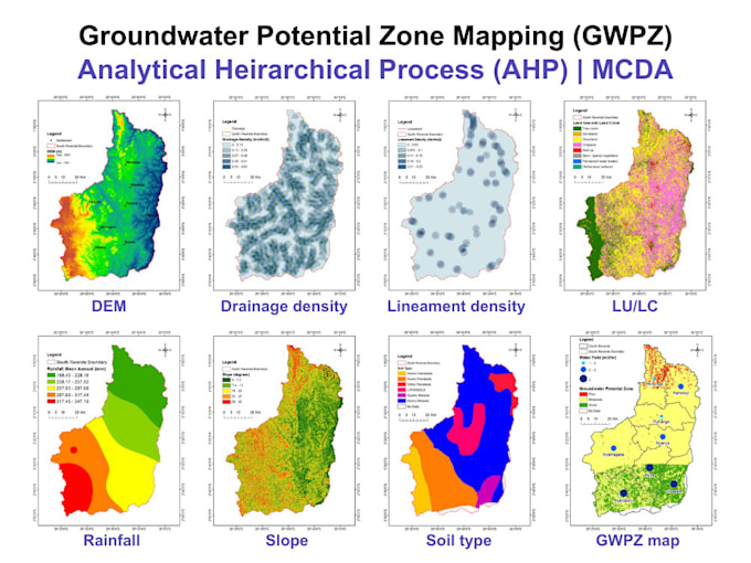
I will do groundwater potential zone mapping

S
s_uroojfatima
S
s_uroojfatima
Urooj Fatima

About this gig

As an environmental GIS expert, I specialize in creating Groundwater Potential Zone (GWPZ) maps using Remote Sensing, GIS, and hydrogeological parameters. These maps are essential for water resource planning, borehole drilling, irrigation, and sustainable development.


What I offer:

️GWPZ mapping based on key factors:

  • Land Use/Land Cover
  • Slope
  • Geology
  • Soil
  • Drainage Density
  • Rainfall or Recharge
  • Lineament Density


-️ Weighted Overlay or AHP-based analysis

-️ High-resolution maps in PDF/PNG/GeoTIFF

️- Custom legend, scale bar, north arrow

️- Professional report summary (if required)

Get to know Urooj Fatima

Urooj Fatima

Environmentalist, Ecologist, Climate Analyst

  • FromPakistan
  • Member sinceJul 2023
  • Avg. response time1 hour
  • Languages

    Urdu, English
ENVIRONMENT | SUSTAINABILITY | ECOLOGY | CLIMATE | FOREST: EIA, IEE, EMP & environmental compliance, Biodiversity, ecological & habitat restoration, BNG, arboriculture & landscape design, Carbon stock, footprint & climate analysis, ESG reporting (GRI, IFRS, SDGs) & blue carbon, GIS & spatial analysis (ArcGIS, QGIS, GEE), Remote sensing (Landsat, Sentinel, MODIS), LULC classification & change detection, Statistical analysis (SPSS, R, Excel, OriginPro), Regression, correlation, PCA & spatial statistics. SECTORS I SERVE: Forest | Ocean | Water | Land | Coastal | Marine | Freshwater

My Portfolio

Other Data Visualization Services I Offer

Related tags