Browse categories
Explore
Fiverr Pro
English
$
USD

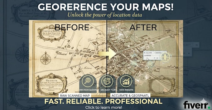

I will professionally georeference your maps, scanned drawings, drone images, aerial photos, and raster datasets using ArcGIS.
This service is ideal for:
What you will receive:
I am a professional hydrographic and geospatial specialist with advanced expertise in GIS and GNSS data processing.
I ensure precise, reliable, and professional results.
GNSS and Hydrographic data processing expert
Languages
what is Georeferencing
Georeferencing is the process of assigning real-world geographic coordinates (latitude/longitude or projection systems) to raster data (scanned maps, aerial photos) or vector data, enabling it to be viewed and analyzed within GIS software.
What types of files can you georeference?
I can georeference scanned maps, satellite images, aerial photos, drone imagery, raster datasets, and engineering drawings. I provide outputs compatible with ArcGIS, including GeoTIFF, TIFF, JPEG, and other formats you need
How accurate will the georeferenced data be?
Your files will be georeferenced with high positional accuracy using ArcGIS tools. I ensure the correct coordinate system (e.g., WGS84, UTM) and proper alignment, so your raster or map can be used for GIS analysis, mapping, or survey work reliably.
