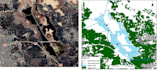
I will digitize scanned maps into gis shapefiles

S
salloumach
S
salloumach
Chergui I

About this gig

I will convert your paper or scanned maps into GIS-ready vector data. Deliverables are provided as shapefiles, with precise digitization suitable for GIS analysis, research, or mapping projects. Georeferencing is included.

PS: If the map contains more features than the package limit, please contact me before ordering.

Get to know Chergui I

Chergui I

Mapping

5.0(1)
  • FromAlgeria
  • Member sinceFeb 2026
  • Avg. response time1 hour
  • Last delivery2 months
  • Languages

    Arabic, English, French
I am a PhD holder in Environmental Science with experience in Geographic Information Systems (GIS). Throughout my academic and professional career, I have applied GIS tools in multiple occasions. I am confident in creating high-quality maps covering your study area, distribution maps, and environmental parameter maps such as NDVI, NDWI, and other remote sensing indices.