Browse categories
Explore
Fiverr Pro
English
$
USD

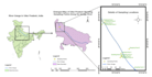
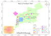
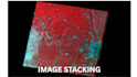
Do you need accurate GIS mapping, satellite image classification, or remote sensing analysis for your academic, environmental, or professional project?
With a Masters degree in Remote Sensing & GIS Applications and hands-on expertise in ArcGIS, ENVI, ERDAS Imagine, and SNAP, I offer precise and high-quality geospatial analysis all without requiring coding.
Services I Provide:
️ Mapping & Preprocessing
️ Remote Sensing & Classification
Deliverables May Include:
Why Choose Me?
Feel free to message me before placing an order.
Languages
What data do you use for remote sensing or classification?
I use freely available satellite imagery such as Sentinel-2, Landsat 8/9, or any dataset provided by the client. I can also work with drone images or client-specific data if shared.
What formats will I receive?
Deliverables can include TIFF, JPEG, PDF, SHP, KMZ, or GeoTIFF depending on your selected package and requirements.
Can I request a custom offer?
Absolutely! If you have a unique project or need multiple services combined, just message me, and I’ll send a custom offer tailored to your needs.
What software do you use for GIS and remote sensing tasks?
I use professional tools such as ArcGIS, ENVI, ERDAS Imagine, and SNAP — all industry-standard software for spatial analysis, image classification, and satellite data processing.
Will I receive a visually appealing final map layout?
Yes! All final maps include legends, scale bars, north arrows, coordinates, and a clear layout — suitable for reports, posters, or presentations.


