Browse categories
Explore
Fiverr Pro
English
$
USD

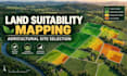
Do you need to identify the most suitable areas for agriculture, farming investment, or site development?
I will create a GIS-based land suitability assessment that combines available spatial evidence into clear maps and ranked zones for better decision-making.
Depending on your package, the assessment may include:
Study-area and parcel mapping
Terrain, elevation, slope, and drainage analysis
Satellite imagery and land-cover review
Soil, geology, water-access, road-access, or climate data when available
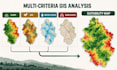
Multi-criteria suitability analysis
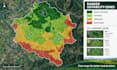
Suitable, moderately suitable, and unsuitable zones
Ranked agricultural sites
Professional maps and a PDF findings report
The criteria and weights will be selected according to your objective, target crop, available data, and agreed assumptions. Data sources, limitations, and uncertainties will be clearly documented.
Important: This is a desktop GIS screening service. It does not replace field surveys, soil and water laboratory testing, agronomic advice, legal land verification, or engineering design.
The listed packages cover one defined study area. Please contact me before ordering for large regions, multiple separated sites, crop-specific model
Independent GIS and Remote Sensing Analyst
Languages
What information do you need to start?
Please provide the study-area boundary or location, your objective, target crop or intended land use, preferred suitability criteria, and any available soil, water, climate, geology, or access data.
Can you assess suitability for a specific crop?
Yes. I can screen the area using available spatial data and the agreed requirements of the target crop. Final decisions should also include field investigations, laboratory testing, and advice from a local agronomist.
Which suitability criteria can you include?
Depending on data availability, the analysis may include slope, elevation, drainage, soil, climate, land cover, water access, roads, protected areas, and other client-defined constraints.
Does the assessment guarantee agricultural success?
No. This is a desktop GIS screening and ranking service. It cannot guarantee crop yield, profitability, water availability, legal approval, or actual field conditions.
Can you compare several agricultural sites?
Yes. I can compare and rank multiple sites. Please contact me before ordering because widely separated sites, large regions, or complex criteria may require a custom offer.


