Browse categories
Explore
Fiverr Pro
English
$
USD


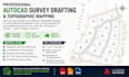
Need professional AutoCAD survey drafting or topographic mapping services? I will create accurate topographic maps, contour drawings, land subdivision layouts, site plans, and boundary drawings from your field survey data, GPS points, sketches, PDFs, or images. With 7+ years of experience in civil and survey drafting, I deliver clean, detailed, and industry-standard DWG files ready for design, submission, or approval.
Services I Offer:
Topographic maps with contour lines
Land subdivision & parcel mapping
Site plans & boundary surveys
PDF/JPG/sketch to AutoCAD DWG conversion
Civil drafting & contour plotting
As-built and survey drawings
Why Choose Me?
7+ years of professional experience
Accurate, clean, and organized drawings
Fast delivery with unlimited revisions
Friendly communication & reliable support
High-quality results tailored to your requirements
Before placing an order, please send your survey data or project details so I can review everything and prepare the drawings exactly as needed.
Please inform the freelancer of any preferences or concerns regarding the use of AI tools in the completion and/or delivery of your order.
Professional AutoCAD Survey Quantity Solutions
Languages
