Browse categories
Explore
Fiverr Pro
English
$
USD


details of your project.
gives you all the information you need to guide you through your research, planning, and decision-making processes.
This package will contain a detailed PDF report for easy factual activation.
I come along with customized mapping solutions in all industries if you are an environmental researcher, urban planner, or developer.
latest and best tools and software.
quality that will enable you
GIS Automation and Deveopler
Languages
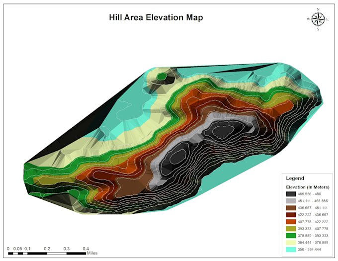
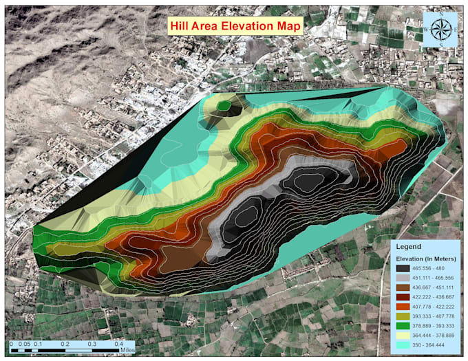
What is a Triangular Irregular Network (TIN)?
A TIN is a spatial data structure that represents a surface by connecting irregularly spaced points to form a network of triangles. It’s useful for modeling terrain and is particularly effective for representing elevation data in a flexible manner.
What is a Digital Elevation Model (DEM)?
A DEM is a 3D representation of a terrain’s surface created from terrain elevation data. It is commonly used in GIS applications for analysis and visualization of topography, hydrology, and various landscape features.
Why should I choose your service for creating TIN and DEM?
I have extensive experience in GIS using ArcMap and ArcGIS Pro. I can efficiently create accurate TINs and DEMs tailored to your specific needs, ensuring high-quality outputs that meet industry standards.
What data do I need to provide for you to create TIN and DEM?
You will need to provide point data with elevation attributes (like XYZ coordinates) or any other relevant datasets. If you have existing GIS files (like shapefiles or raster data), those can also be used to generate the TIN and DEM.
How long will it take to complete my project?
The turnaround time varies based on the complexity and size of your dataset. Typically, you can expect your TIN and DEM to be ready within 3-5 days. I’ll provide a more precise estimate once I review your specific requirements.
What formats will the final TIN and DEM be provided in?
I can deliver the final TIN and DEM in various formats, including shapefiles, GeoTIFFs, or any format you prefer compatible with your GIS software.
Can you help with analyzing the TIN and DEM?
Absolutely! In addition to creating TINs and DEMs, I can also perform spatial analyses, such as slope, aspect, and watershed analysis, and provide insights based on your project needs.
What if I need revisions?
I offer a revision policy to ensure your satisfaction. After delivering the initial TIN and DEM, you can request changes, and I will make adjustments as needed within the agreed scope of the project.
Do you offer support after the project is completed?
Yes! I provide support for a limited time after project completion to answer any questions you may have regarding the TIN or DEM or how to use the outputs in your GIS applications.
How do I get started?
Simply click the "Order Now" button, provide the necessary details about your project, and upload any relevant data. I’ll review your requirements and get started on creating your TIN and DEM!