Browse categories
Explore
Fiverr Pro
English
$
USD

I will develop custom GIS tools, ArcGIS scripts, and QGIS plugins tailored to your geospatial needs. Whether you require Python GIS automation, spatial analysis tools, or a full-featured geoprocessing application, I can deliver fast, professional, and reliable solutions.
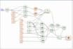
With expertise in ArcPy, PyQGIS, GDAL/OGR, and other GIS libraries, I create tools that automate workflows, process raster and vector data, and provide accurate, efficient results.
Services I Offer:
Why Choose Me?
Professional GIS software development experience
100% customized tools for your workflow
Clean, optimized, and documented code
Excellent communication & support
Fast and reliable delivery
If you need a GIS tool, ArcGIS script, or QGIS plugin that saves time and boosts productivity, contact me today to get started.
GIS Automation and Deveopler
Languages
What GIS platforms do you support?
I work with ArcGIS Pro, ArcMap, QGIS, and standalone Python-based GIS applications.
Can you automate my existing GIS workflow?
I can convert manual workflows into automated scripts or tools to save you time and effort.
Do I need to provide data?
If possible, yes. Providing sample data helps me test and ensure the tool works perfectly for your needs.
Can you create tools with a user-friendly GUI?
Absolutely. I can build desktop GIS tools with GUI using PyQt5, making them easy to use without coding knowledge.
Can you integrate my GIS tool with a database or API?
Yes, I can connect tools to PostGIS, MySQL, or external APIs for advanced geospatial data management.


