Browse categories
Explore
Fiverr Pro
English
$
USD

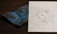
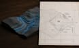
Need an accurate contour map, professional topographic layout, or land survey site plan?
As a GIS and Civil CAD professional, I translate complex geographic elevation data into clean, engineering-ready files. Whether your project requires raw GPS survey points, DEM data, or extraction from Google Earth Pro, I deliver exact geometric results.
WHAT I DELIVER:
SOFTWARE PIPELINES:
WHY CHOOSE THIS GIG:
Lets ensure your land project is perfectly engineered, Order your precise map today!
Fiverr does not screen freelancers in this category. Please verify qualifications and discuss requirements with the freelancer before ordering, including any preferences regarding the use of AI tools.
GIS Mapping and Contour Map Specialist
Languages
What raw data formats do you accept to begin the mapping process?
I accept an extensive array of input sources, including raw survey data points (CSV, TXT, Excel), GPS coordinates, drone orthophoto images, PDF sketches, or simply a Google Earth KMZ boundary file of your location.
Will the final AutoCAD file be structured cleanly into separate CAD layers?
Yes, Your file will arrive with professional layer management, Major contour indexes, intermediate lines, elevation texts, boundaries, and grid points are completely separated onto distinct, labeled, and color-coded layers.
Can you deliver maps matched to specific global or regional coordinate networks?
Absolutely, Please specify your target coordinate reference system (such as WGS84 or a regional State Plane projection) at checkout, and your maps will be accurately georeferenced.
Do you offer 3D surface modeling files along with standard 2D views?
Yes, 3D surface creation is fully supported, I can deliver complete Autodesk Civil 3D surfaces or digital elevation models (DEM) via my Standard and Premium tiers
What if I only have a coordinate address but no formal survey files?
Not a problem, I can use professional spatial databases and satellite instrumentation pipelines to extract precise elevation datasets directly from your location bounds


