Browse categories
English
$
USD
Connect to your AI

Unlocking geospatial potential!
With over 7 years of expertise, I offer tailored GIS solutions to meet your needs:
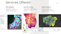
1. GIS Analysis: Delivering precision-driven insights for informed decision-making.
2. Web GIS Applications: Creating dynamic mapping solutions for enhanced visualization.
3. Mapping and Cartography: Crafting visually captivating representations for effective communication.
4. Satellite & Drone Imagery: Extracting valuable insights from aerial perspectives.
5. Terrain Analysis: Providing detailed insights into landscape dynamics and geomorphology.
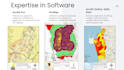
6. Expert Tools: Proficient in utilizing ArcGIS for comprehensive geospatial analysis.
Expertise software,
Let's collaborate to unlock the full potential of your geospatial projects!
Languages


