Browse categories
Explore
Fiverr Pro
English
$
USD


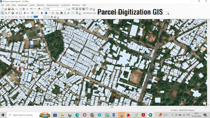
I am a GIS Analyst with experience in ArcGIS digitization, georeferencing, shapefile creation, and GIS mapping services.
I can help you with:
Building digitization from satellite images
Parcel / land boundary digitization
Road network digitization
Georeferencing scanned maps and toposheets
PDF / Image map to GIS shapefile conversion
CAD to GIS conversion
Map layout and thematic maps
Shapefile and geodatabase creation
I work using ArcGIS, QGIS, Global Mapper, Google Earth, and AutoCAD and ensure accurate digitization, proper coordinate systems, and clean GIS data suitable for planning, survey, mining, and mapping projects.
Please contact me before placing an order so we can discuss your project requirements.
Please inform the freelancer of any preferences or concerns regarding the use of AI tools in the completion and/or delivery of your order.
Languages